|
|
|
#1
 06-04-12, 01:15
|
|||
|
|||
|
Hello Les,
What a beautiful image! I always love seeing new (to me!) photos of Crabs, and this one is reallly nice. Looking at it, I was feeling that the hills in the background, the buildings, quays and barge had a definite "Seine" flavour to them. Then a tiny bell rang somewhere in the back of my head, and prompted me to check the Lothians War Diary and, sure enough, here it was (from War Diary 'A' Sqn 1 Lothians & Border Yeomanry): "28 Aug [1944] The Sqn crossed the Seine at Elbeuf behind the armd bde, highly organised with marshalling areas etc and the bridge - a Bailey single tier on pontoons - quite easy for us. We harboured in the valley on the East bank and were engaged by sporadic mortar and 88mm shellfire, not to forget tempestuous rain." No sign of "tempestuous rain" on the photo (it probably came during the evening), but the description of the bridge certainly fits. Then I looked up Elbeuf on GoogleEarth, but no luck, nothing recognizable as no old buildings remained. So I resorted to one of my favorite time machines, an invaluable website which seems to have old postcards about every single hamlet in France, and yielded literally THOUSANDS on Elbeuf alone: https://www.delcampe.fr/fr/collectio...earch_mode=all And bingo! This is indeed Elbeuf! The pontoon bridge was built just a few yards downstream of the old suspension bridge, which had been destroyed by then (I took the liberty of posting Les' photo again for easier comparison): 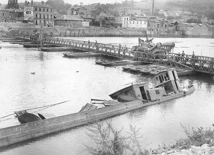 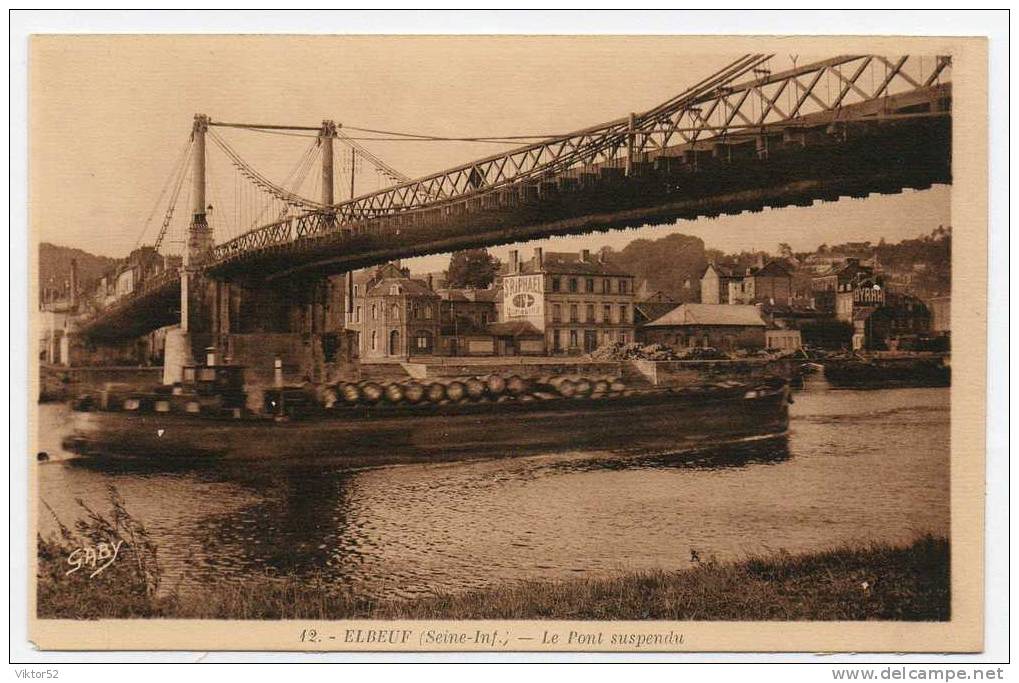 A postwar photo this time, shot from nearly the same angle, but from further back and much higher up: an oblique aerial view of the new suspension bridge ("Pont Guynemer") which replaced the old one. The various buildings are clearly visible: 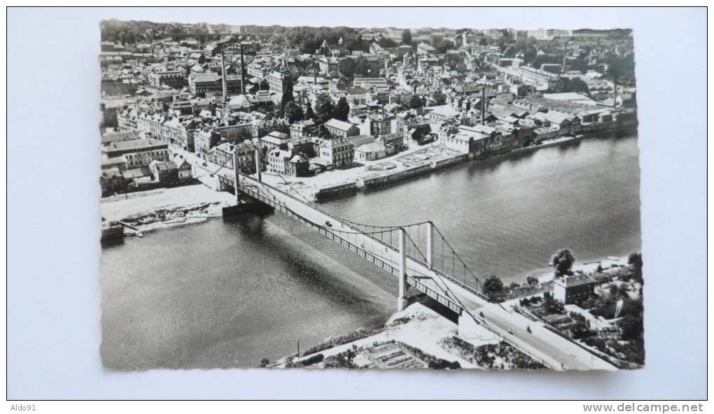 Back to prewar postcards, here's a view from the bridge itself. The corner house on the right is the one just right of the bridge pile on the previous postcard: 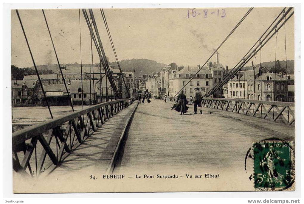 Still from the East bank, but from the right side of the bridge (just right or downstream of the above 2 pics): the photographer's location is more or less where the pontoon bridge lands: 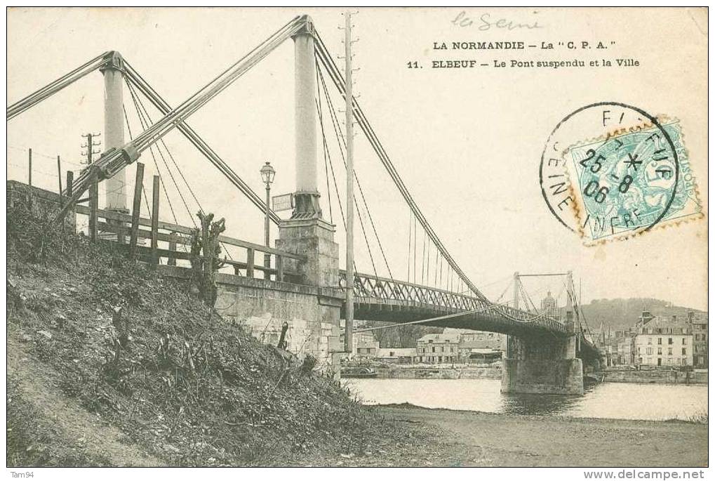 Another view, from further upstream (left) this time, still from the same side (East bank) of the river. The wooden posts around the middle of the pontoon bridge seem to correspond with the centre pile of the old suspension bridge: 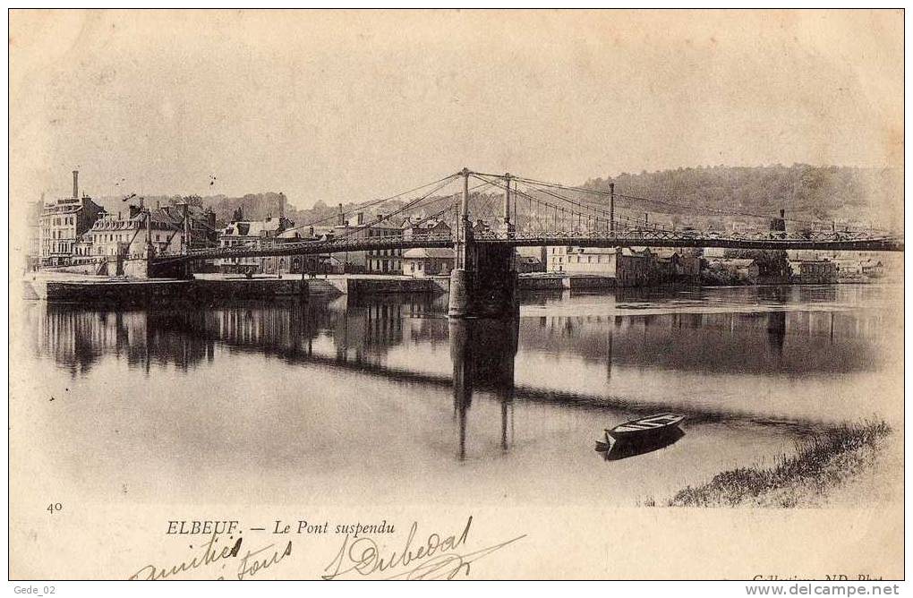 The areas to the left and to the right of the bridge on the West bank (the far bank on the above photos) are the quays of Elbeuf ("Le Port"), were the Seine barges loaded or unloaded their goods. Here's a close up of "Le Port" (the large house on the left is the one with the "St Raphaël" advert, and the white building with the chimney to the right is one of the textile dyeing works): 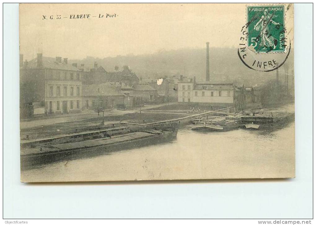 The dyeworks and their chimneys: 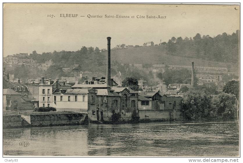 Here's a view from the West bank. The photographer of the pontoon bridge took the shot from the opposite bank, probably perched on the ruins of the old suspension bridge pile there. The pontoon bridge started from the stairs on the left foreground of the photo (where a couple of boats are tied): 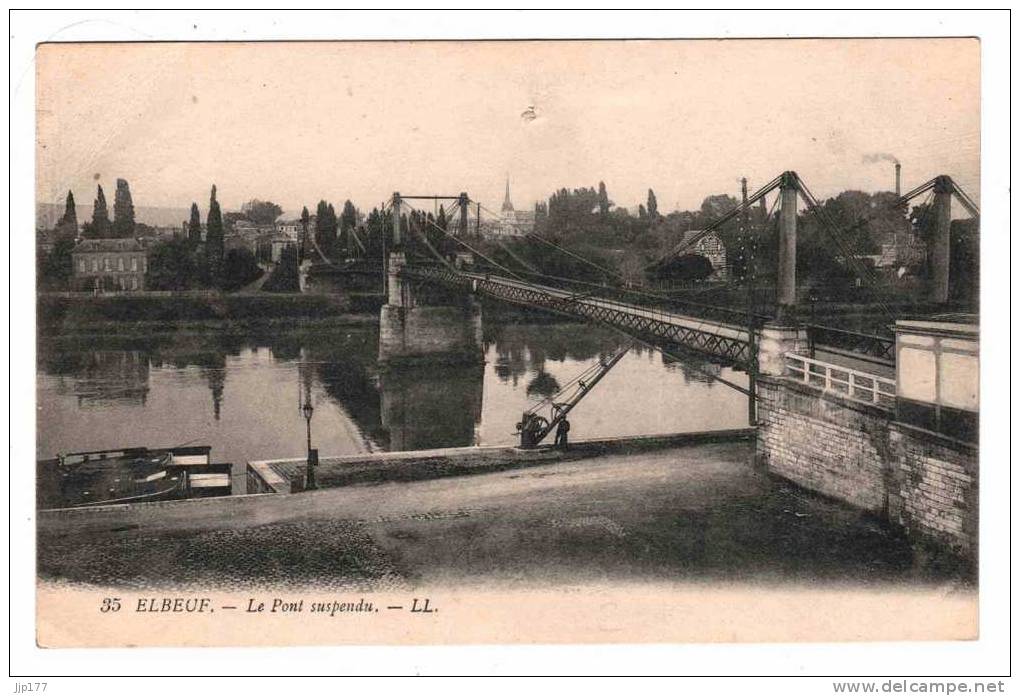 A general view of the quays and bridge from upstream on the West bank. The dyeworks can be seen just beyond the bridge pile on the left: 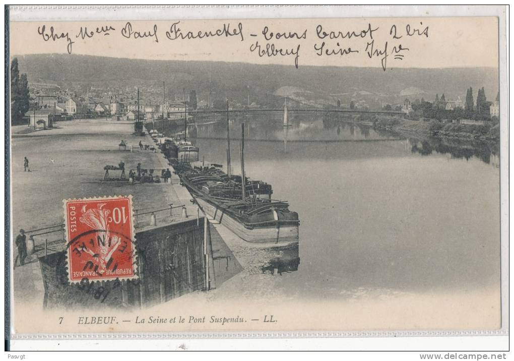 Les, do you have a higher resolution version of your photo, where perhaps we can see the Crabs better? Michel Sabarly Last edited by MicS; 25-08-17 at 09:59. Reason: Display images instead of just links 
|
|
#2
23-03-13, 16:03
|
||||
|
||||
|
Quote:
I have an original copy of the First Edition of the Sherman Crab Instruction Book - have you seen this? If not, am happy to post some photos from it. Let me know Tim
|
|
#3
21-12-13, 10:39
|
||||
|
||||
|
Hello everybody! I'm looking for information about Bailey Mk.II bridges, that should mean "original" British materiel and not US M1/M2 types. There is one still "living", in use since the 50s or 60s in my whereabouts in Italy. I still have to take measurements and pictures, though I've been driving on this bridge for decades - maybe I always took it for granted as I was used to it since my childhood - but now I want to research its story in depth.
At first I thought it was standard US/NATO issue, which was also widely employed by the Italian Army in those years, but the width doesn't seem to fit and the markings on it are clearly British and not US. So maybe it was really "WW2 surplus" when it was fitted, or the Italian Army had manuals describing the M1A/M2 but actually had in use also the British version. I have been unable to locate detailed information and drawings, apart from a couple web articles etc., mostly regarding the US version: is anybody able to provide scans or links to publications? I guess there was some official manual in the British Army, like the FM 5-227 for the US Army...
|
|
#4
22-12-13, 14:32
|
|||
|
|||
|
In the photo Michel posted of the bridge at Elbeuf (post 162). What is the tracked vehicle in the left foreground with the engine covers open?
It looks a little strange. David
__________________
Hell no! I'm not that old!
|
|
#5
22-12-13, 14:56
|
|||
|
|||
|
Quote:
Michel
|
|
#6
23-12-13, 13:26
|
|||
|
|||
|
Thanks Michel, maybe it's the angle from which the photo was taken but I couldn't work out what it was. The onlookers must be obscuring the front wheel.
David
__________________
Hell no! I'm not that old! Last edited by motto (RIP); 23-12-13 at 13:31.
|
 |
| Thread Tools | |
| Display Modes | |
|
|


 Hybrid Mode
